
Tree Surveys & Safety Audits
Systematic tree inspections, risk assessment and management recommendations supported by accurate spatial data and up-to-date site mapping.
Thrive Arbor provides professional tree surveys and safety audits for organisations responsible for managing multiple trees across public, commercial and institutional sites. Our AQF Level 5 Arborists combine advanced arboricultural knowledge with more than 20 years of practical tree-management experience.
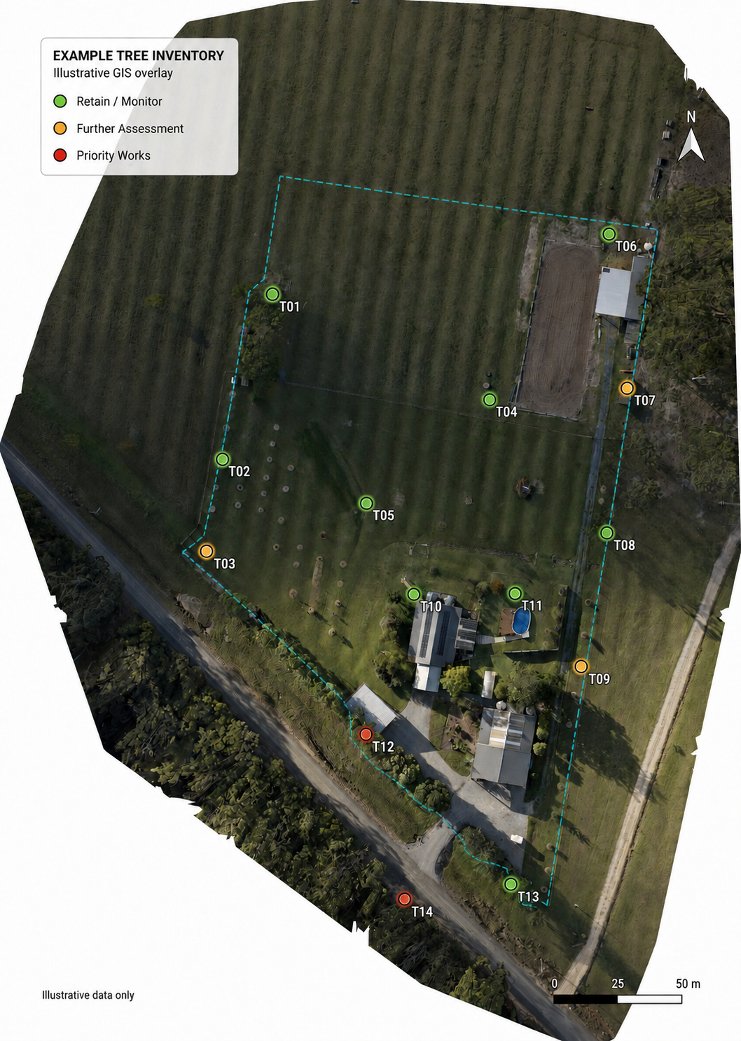
Using drone orthomosaic mapping, survey-grade GNSS/GPS equipment and GIS technology, we can produce clear, accurate records showing where trees are located, their condition and the management actions recommended for each tree.
We help clients understand their tree population, identify priority concerns and establish a structured, evidence-based program for future inspection and maintenance. Services are available throughout the Clarence Valley, Coffs Coast and Northern NSW.
Tree Inventory Surveys
A tree inventory survey creates a structured record of the trees across a property or defined project area.
It provides reliable baseline information for ongoing tree management, development planning, budgeting and future inspections.
Depending on the purpose and scale of the survey, the inventory may record:
Unique tree identification number
Species and common name
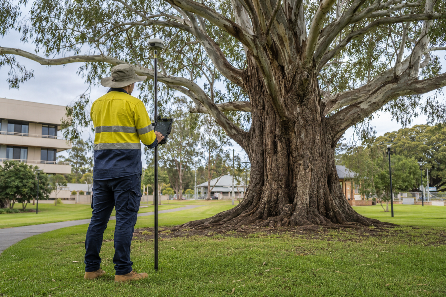
Location captured using survey-grade GNSS/GPS equipment
Height, trunk diameter and canopy dimensions
Age or maturity class
Health and structural condition
Visible defects and site-related concerns
Retention value or management significance
Recommended works and priorities
Suggested inspection frequency
Tree information can be supplied through clearly numbered plans, schedules and GIS datasets, allowing individual trees to be readily identified during future inspections and maintenance work. Physical tree tags can also be installed where required.
Drone Mapping, Survey-Grade GPS and GIS
Existing aerial imagery is often outdated, unclear or unsuitable for accurately displaying individual trees and current site features. Where appropriate, Thrive Arbor can capture current drone imagery and process it into a high-resolution orthomosaic map of the site.
Tree locations and field observations are collected using survey-grade GNSS/GPS equipment and plotted within a Geographic Information System (GIS). This allows tree records, inspection findings and management recommendations to be connected to reliable spatial locations and displayed against clear, up-to-date site imagery.
Depending on the project scope, spatial deliverables may include:
High-resolution drone orthomosaic imagery
Accurately plotted tree locations
Numbered tree inventory and risk-management plans
Tree attribute and recommendation schedules
GIS-compatible digital datasets
Maps showing work priorities or inspection categories
Data suitable for future updating and ongoing asset management
This integrated approach provides councils, schools, property managers and project teams with a much clearer understanding of the site than a standalone spreadsheet or tree schedule.
Tree Safety Audits
Tree safety audits provide a systematic assessment of trees in areas where their condition or potential failure could affect people, buildings, roads, vehicles or other property.
The appropriate level of assessment depends on the site, tree population and patterns of use. A broad survey may be used to screen a large number of trees and identify those requiring priority work or further investigation. Trees with significant defects or more complex concerns can then be referred for a detailed assessment.
Our assessments consider:
Tree health, structure and vitality
Visible defects or indicators of weakness
Previous failures or inappropriate pruning
Soil, root-zone and growing-site conditions
Surrounding targets and patterns of site use
Likelihood and potential consequences of failure
Practical options for reducing identified risk
Where appropriate, Quantified Tree Risk Assessment (QTRA) methodology can be used to support risk-based decisions and management recommendations.
Clear, Prioritised Recommendations
The purpose of an audit is not simply to identify defects. It is to help site managers decide what requires attention, when it should occur and which actions will provide the greatest benefit.
Recommendations may include:
Priority pruning or tree removal
Further detailed or aerial inspection
Root-zone investigation
Target or access management
Monitoring of identified defects
Recommended reinspection intervals
Tree protection or establishment measures
Replacement planting and succession planning
Recommended works can be grouped by priority, timeframe or location and displayed on site maps. This helps organisations direct available budgets towards the most important actions first and enables contractors to clearly identify the trees and works specified.
Who We Work With
Tree surveys and safety audits are particularly valuable for:
Local councils and government agencies
Schools and educational facilities
Commercial and industrial properties
Retirement villages and community facilities
Strata and property-management portfolios
Parks, reserves and recreational sites
Infrastructure corridors and project sites
Large private properties and rural holdings
Surveys can be tailored to a single area, a particular group of trees or an entire property portfolio.
Supporting Responsible Tree Management
A documented inspection and maintenance program provides site managers with a clearer understanding of their tree assets and a record of the decisions made in response to identified concerns.
Regular inspections can help organisations:
Identify emerging concerns before they become urgent
Prioritise work according to risk and site needs
Plan future maintenance expenditure
Retain healthy and valuable trees where appropriate
Avoid unnecessary or poorly targeted tree work
Demonstrate a considered approach to inspection and maintenance
Maintain consistent records as staff or contractors change
Why Organisations Choose Thrive Arbor
-

AQF Level 5 Arborists
Assessments and reports prepared by appropriately qualified consulting arborists.
-

Practical Industry Experience
Recommendations informed by more than 20 years of hands-on tree-management experience.
-

Advanced Mapping Capability
Drone orthomosaic imagery, survey-grade GNSS/GPS data collection and GIS mapping.
-

Evidence-Based Risk Assessment
Clear, proportionate recommendations based on tree condition, site use and potential consequences.
-

Arboricultural & Environmental Expertise
Balanced decisions considering tree risk, retention, habitat value and long-term management.
-

Clear, Practical Reporting
Well-structured reports, maps and recommendations that clients and contractors can readily implement.